&fill=rgba(0,0,0,0))
Kocbekov dom na Korošici depuis Kamniška Bistrica - Pred Belo
 This route is provided by the Camp to Camp community. Click here to access it directly on their website.

Accès au refuge Kocbekov dom (au bassin Korošica, en versant S de l'[[waypoints/581941|Ojstrica]]) depuis la vallée Kamniška Bistrica (parking "Pred Belo").
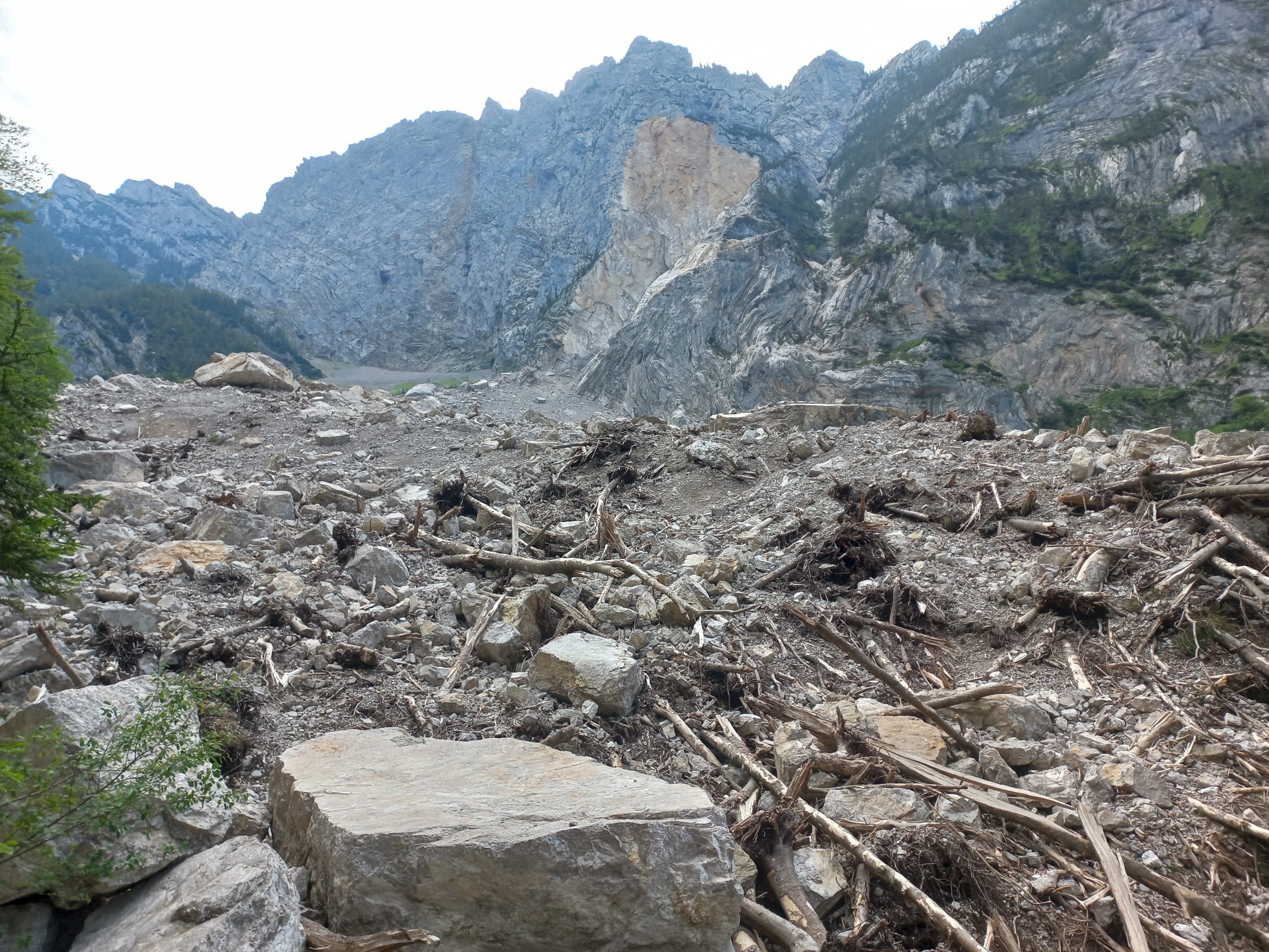
!!!!Chemin temporairement fermé suite à un énorme éboulement au [[waypoints/815018|Rzenik]].
Au parking de **Pred Belo** (à droite, 1,5 km avant le terminus routier de Izvir Kamniške Bistrice), emprunter le chemin fléché Ojstrica qui avance NE le long de la **Dolina Kamniške Bele**. Après deux kilomètres à plat, il s'élève rapidement en forêt pour rejoindre le col de **Presedljaj**.
Le chemin traverse en ascendance, passe un goulet délicat et emprunte alors au N un sentier tout en montagnes russes sur un long plateau, jusqu'au col de **Prag** (1910 m), puis plonge vers le refuge **Kocbekov Dom na Korošici**.


