&fill=rgba(0,0,0,0))
Skaly pod Pariakovou - 576
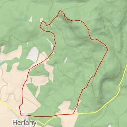
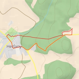
This hiking route will take you through the beautiful area of Skaly pod Pariakovou. The trail spans a distance of 7.573 kilometers with an elevation gain of 103.0 meters, making it a difficult yet rewarding journey.
As you embark on your hike, you will come across several points of interest along the way. At the beginning of the trail, you will find a parking area where you can leave your vehicle before starting your adventure. As you continue, you will reach Herlianske sedlo, a scenic viewpoint located just 0.01 kilometers from the start of the trail.
Further along the path, you will encounter picnic sites and rock formations, adding to the natural beauty of the surroundings. A shelter is also available approximately 2.97 kilometers from the trailhead, providing a resting spot for weary hikers.
One of the highlights of the hike is a rock formation with an attraction point located 3.29 kilometers from the start. This unique feature is sure to captivate and amaze all who visit.
As you trudge along the trail, you will reach a saddle known as Herlianske sedlo, situated just 0.01 kilometers from the beginning of the route. From here, you can enjoy breathtaking views of the surrounding landscape.
To conclude your journey, a viewpoint awaits you approximately 1.33 kilometers from the start, offering a stunning panorama of the area.
Before embarking on this challenging hike, be sure to bring an ample water supply and check the weather forecast to ensure a safe and enjoyable experience. The route is an out-and-back type, meaning you will retrace your steps on the way back.
Overall, the Skaly pod Pariakovou hiking route promises a memorable adventure filled with natural wonders and scenic vistas.