&fill=rgba(0,0,0,0))
Krumme Lanke

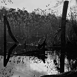


This hiking route takes you through the beautiful area surrounding Krumme Lanke. The trail is a circular route with a distance of 2.77 kilometers and is rated as easy in terms of difficulty, making it suitable for hikers of all levels.
As you start your journey, you will pass by some notable points of interest. At the beginning of the trail, you will find a parking area for your convenience. Further along the route, you will come across the picturesque beaches of Vierling and other natural spots for a relaxing break.
If you find yourself hungry during the hike, there are a couple of restaurants nearby, like Restaurant Gourmet Sud and Wu's, where you can grab a bite to eat. There are also several bicycle parking spots along the trail for those who prefer biking to hiking.
For those interested in history and art, you will encounter memorials and artworks such as Flügelsäule and Versus along the way. Additionally, there are benches and information points scattered throughout the trail for resting and learning more about the surroundings.
Don't forget to bring plenty of water, especially on warmer days, and check the weather forecast before heading out. With its scenic views and easy terrain, the Krumme Lanke hiking route offers a pleasant outdoor experience for nature lovers and casual hikers alike.


