Hiking : Езеро
Bulgaria Blagoevgrad
&fill=rgba(0,0,0,0))
Durée
Distance
Dénivelé
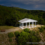
This hiking route takes you through a beautiful area with a serene lake at the center. The trail is a circular route with a distance of 1.566 kilometers and no elevation gain, making it super easy and perfect for all skill levels.
As you start your journey, you'll pass by a couple of parking areas close to the trail, ensuring a convenient start to your hike. Just 0.14 kilometers from the beginning, you'll find a spot to refill your water bottle with mineral water, providing a refreshing break early on.
Moving along the trail, at about 0.58 kilometers from the start, you'll come across a charming fountain where you can rest and enjoy the peaceful surroundings. Further ahead, at 0.75 kilometers, there's a cozy cafe offering a perfect stop for a quick snack or beverage.
Continuing on, you'll encounter more drinking water spots and eateries along the way, ensuring you stay hydrated and energized throughout your hike. As you reach the midway point at 0.71 kilometers, there's a notable attraction - the house of Baba Yaga, adding a touch of folklore to your adventure.
Towards the end of the trail, you'll spot a few more monuments and restaurants, allowing you to delve into the local history and cuisine before completing your circular journey back to the starting point.
Remember to bring an ample water supply, wear comfortable hiking shoes, and check the weather forecast before heading out. With its easy terrain and scenic views, this hiking route promises a delightful outdoor experience for nature enthusiasts and casual hikers alike.


