Hiking : Haggin Museum - North Pershing Avenue - Stockton
United States California San Joaquin County Stockton
&fill=rgba(0,0,0,0))
Durée
Distance
Dénivelé
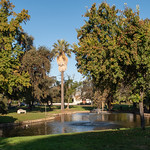
This hiking route will take you through the Haggin Museum area on North Pershing Avenue in Stockton. The trail is super easy, with a distance of 1.172 kilometers and no elevation gain.
As you start your hike, you will come across a parking area located right at the beginning of the trail. This will allow you to easily park your vehicle before embarking on your outdoor adventure.
Continuing along the trail, about 0.54 kilometers from the start, you will find a water source where you can refill your water bottles and stay hydrated during your hike. Further along, at around 0.59 kilometers from the start, there is another water source available for hikers.
This out-and-back route offers a leisurely hike with no significant challenges in terms of distance or elevation. It is important to bring an adequate supply of water, especially on warm days, and to check the weather forecast before heading out.
Enjoy the peaceful surroundings and cultural landmarks along the trail as you explore the Haggin Museum area in Stockton.
Other routes nearby


