Max-Fischer-Straße
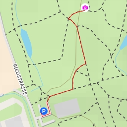
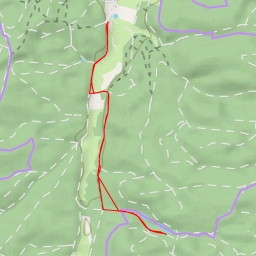
This hiking route at Max-Fischer-Straße offers a super easy trek that is perfect for a leisurely outdoor experience. The trail spans approximately 1.905 kilometers with no significant elevation gain, making it suitable for hikers of all levels.
Starting at the designated parking area, you will begin your journey through the picturesque surroundings. Along the way, you will find convenient amenities such as benches for resting and taking in the serene views. The first bench is located just 0.48 kilometers from the start, providing a nice spot to relax before continuing on the trail.
As you progress further, you will encounter various water features including the "Fischtreppe" at the 0.8-kilometer mark. This interesting attraction adds charm to the hike and is a great photo opportunity. Additionally, there are several other water points scattered along the way, offering a refreshing sight and a chance to connect with nature.
Midway through the hike, you will come across a bicycle parking area at 0.04 kilometers, providing a convenient spot for cyclists to take a break. This spot also serves as a marker for the halfway point of your journey.
Before embarking on this hike, be sure to pack essentials such as water, snacks, and sunscreen. It is also recommended to check the weather forecast beforehand to ensure a safe and enjoyable outing.
Overall, this out-and-back trail at Max-Fischer-Straße is a delightful outdoor adventure that showcases the beauty of the natural surroundings. Whether you are looking for a quick stroll or a peaceful hike, this route is sure to offer a memorable experience for all outdoor enthusiasts.