&fill=rgba(0,0,0,0))
Krvavec

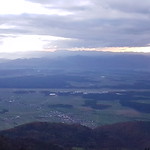


Located in the scenic Krvavec area, this hiking route offers a pleasant and easy trek for nature enthusiasts. The 2.272 km long trail with an elevation gain of 159 meters can be completed in approximately 55 minutes.
Starting off at the parking area, hikers will begin their journey through the picturesque surroundings. As you make your way along the trail, you will come across a restaurant about 0.21 km from the start, where you can take a break and refuel. Further along the route, at a distance of 0.15 km from the start, there is another restaurant for hikers to enjoy.
One of the highlights of the hike is the Krvavec site for free-flying enthusiasts, located 1.11 km from the start. This spot offers a unique opportunity to witness aerial activities and enjoy the stunning views from above.
The circular route takes hikers through varied terrain, providing a mix of natural beauty and recreational facilities. It is advisable to carry an adequate supply of water and check the weather forecast before embarking on the hike. Overall, this trail is suitable for hikers of all levels, offering a chance to explore the beauty of the Krvavec area.


