Relief Maps : the best FATMAP alternative
Relief Maps: The Best FATMAP Alternative
The backcountry community was left with a void when FATMAP was discontinued and partially folded into Strava. For many, the transition meant losing critical tools: high-fidelity 3D terrain visualization, intuitive route planning, and specialized winter layers that made off-piste exploration safer and more accessible.
If you are looking for the true successor to the experience you loved, Relief Maps is the answer. It is not just a navigation app; it is a comprehensive 3D outdoor toolkit designed to fill the gap left by FATMAP, restoring the features you miss while introducing powerful new technology.
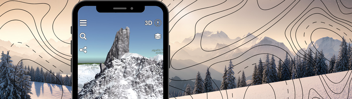
3D Maps at Its Heart
Just like the platform you miss, Relief Maps is built around a stunning, high-performance 3D engine. It doesn't just overlay a flat map onto a hill; it provides a fully immersive 3D terrain view that allows you to virtually scout lines before you even leave your house. Whether you are visualizing a ridge traverse or checking the steepness of a couloir, the 3D visualization is smooth, detailed, and central to the experience.

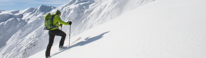
Advanced Avalanche Risk Management
Safety in the backcountry relies on understanding the terrain, and Relief Maps brings back the essential visual tools for risk assessment:
- Slope Shading: Instantly visualize slope angles to identify avalanche-prone terrain (typically between 30° and 45°). This layer is crucial for planning safe ascents and descents.
- Aspect Maps: Know exactly which way a slope faces. This tool is vital for predicting snow quality (finding powder on north faces or corn on south faces) and assessing stability based on solar radiation and wind loading.
- Avalanche Bulletins: Access up-to-date avalanche bulletins across all of Europe directly within the app. You no longer need to switch between different websites to get the local danger rating; it is integrated right where you plan your route.

Powered by SnowAI Technology
Relief Maps introduces SnowAI, a cutting-edge technology designed to enhance winter exploration. This feature processes satellite imagery to give you the most accurate and readable winter maps available. It helps distinguish snow cover from rock and ice with greater clarity, ensuring that what you see on the map matches the conditions you will face on the mountain.

Community-Driven Route Planning
One of the biggest losses with FATMAP was the community content. Relief Maps solves this by integrating directly with the most active ski touring communities in Europe: skitour.fr and camptocamp.org.
- Access Thousands of Routes: Browse a massive database of ski touring and mountaineering itineraries created by local experts.
- Easy Planning: The route planner is intuitive and fast. You can trace your path in 3D, check the stats (distance, vertical gain), and export the GPX file to your device or watch in seconds.
Why Make the Switch?
Relief Maps isn't just trying to replace FATMAP; it is aiming to improve upon the formula. By combining professional-grade topography with the community knowledge of Skitour and Camptocamp, it offers a tool that is both technical and social.
If you want a dedicated outdoor app that prioritizes 3D exploration, safety tools, and community routes—without getting lost in a general fitness app—Relief Maps is the upgrade you have been waiting for.
Give it a try now
You can find Relief Maps on Android and iOS here: