Relief Maps
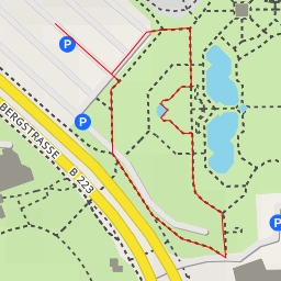
AI - Informationstafel Gleispark Frintrop - Essen
Duration
00:00
Distance
0.92 km
Elevation
0.0 m
Open in Relief Maps
Download GPX
All hiking routes
Other routes nearby
Josef-Albers-Museum/Quadrat - Anni-Albers-Platz - Bottrop
Hälterungsbecken
Fernewaldstraße - Fernewaldstraße - Bottrop
Teich 6
Gungstraße - Gungstraße - Bottrop
Mottbruchhalde
Halde 19
Kfar-Saba-Brücke - Mülheim an der Ruhr