Relief Maps
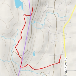
AI - City of Meriden Watershed Reserve Land - Meriden
Duration
00:47
Distance
2.866 km
Elevation
132.0 m
Open in Relief Maps
Download GPX
All hiking routes
Other routes nearby
AI - East Peak
AI - Julian's Rock
AI - Compounce Ridge Trail - Southington
AI - Compounce Ridge Trail - Southington
AI - Roaring Brook, cataracts
AI - Southington
AI - Black Pond
AI - Halfway House - Meriden