Relief Maps
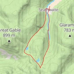
Codale Head
United Kingdom
›
England
›
Westmorland and Furness
Durée
03:20
Distance
7.78 km
Dénivelé
615.0 m
jlenman
jlenman
boydharris
Ouvrir dans Relief Maps
Télécharger le GPX
Toutes les randos
Autres itinéraires à proximité
Slate Knott
Glaramara Stone Axe Factory - Stockley Bridge
High Knott
B5289 - B5289
AI - Brandlehow Lead Mine - Keswick
Great End
Lingcove Beck Falls (upper)
Lingcove Bridge - Lingcove Bridge