Hiking :
Switzerland Jura District de Porrentruy
&fill=rgba(0,0,0,0))
Durée
Distance
Dénivelé
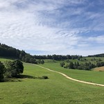
This hiking route takes you through a beautiful area with a total distance of 8.54 kilometers and an elevation gain of 337 meters, making it a difficult trek that will challenge even experienced hikers.
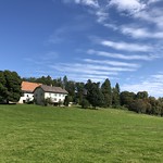
You will start your journey at the parking area, which is conveniently located right at the beginning of the trail. As you make your way along the path, you will come across Cabane Les Echos, a shelter where you can take a break and enjoy the surroundings just 36 meters from the trail.
Further along the route, at a distance of 1.41 kilometers from the start, you will find the entrance to Grottes de Saint-Nicolas, a cave that you can explore without any entrance fee. Nearby, at 1.43 kilometers from the start, there is another entrance to the same caves, offering a unique underground experience.
Midway through the hike, at 4.27 kilometers from the start, you will encounter a water source, perfect for refilling your water bottle and staying hydrated on the challenging trail.
As this is an out-and-back route, you will retrace your steps on the way back, giving you the opportunity to appreciate the stunning scenery from a different perspective.
Remember to bring plenty of water, wear sturdy hiking shoes, and check the weather forecast before setting out on this demanding adventure. Stay safe and enjoy the natural beauty that awaits you on this exhilarating hike.


