&fill=rgba(0,0,0,0))
Coit Tower & East Bay

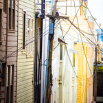


This hiking route takes you to the beautiful area of Coit Tower & East Bay. The trail is super easy with no elevation gain, making it suitable for hikers of all levels.
As you start your hike, you will pass by Union Larder, a restaurant located 0.47 kilometers from the trail. Further along, at 0.14 kilometers from the start, you will come across the George Sterling Memorial, a historic landmark. Continuing on, you will reach the Lombard Street Reservoir at 0.3 kilometers from the start and Lombard Street at 0.36 kilometers.
Throughout the hike, you will also find various dining options such as Za Pizza, Abrazo, Swensen's Ice Cream, Baccus, Elephant Sushi, and Frascati. Remember to bring enough water and snacks as these restaurants are located off the trail.
Along the way, there are several viewpoints including Coit Tower & Bay Bridge view at 0.54 kilometers from the start. Be sure to take in the breathtaking views of the Golden Gate Bridge & Richardson Bay at 0.03 kilometers.
As this route is an out-and-back type, you will return to the starting point after reaching the destination. Before embarking on this hike, make sure to check the weather forecast and carry essentials like water, snacks, and proper hiking gear. Enjoy your hike to Coit Tower & East Bay!


