Ablanca
Welcome to the hiking route to Ablanca!
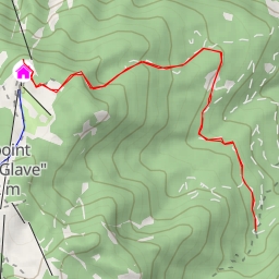
This challenging 8.082-kilometer out-and-back trail offers stunning views and a variety of points of interest along the way. Starting from the parking area at the trailhead, hikers will make their way through a scenic landscape with an elevation gain of 627 meters.
Along the route, you will encounter several interesting points of interest. Approximately 3.76 kilometers from the start, you will reach Studorski preval, a picturesque saddle offering breathtaking views of the surrounding area. Around 2.98 kilometers into the hike, you will find a refreshing spring, perfect for refilling your water bottle.
As you continue on the trail, you will come across a historic wayside cross located 1.43 kilometers from the start, and a peaceful bench 2.9 kilometers into the hike where you can take a break and enjoy the surroundings. Further ahead, at approximately 3.03 kilometers from the start, there is another stunning viewpoint offering panoramic views of Ablanca.
The highlight of the hike is reaching the peak of Ablanca, located 4.04 kilometers from the start. Here, you can take in the majestic scenery before retracing your steps back to the trailhead.
Please note that this trail is rated as difficult due to its length and elevation gain. Make sure to wear sturdy hiking shoes, bring an adequate supply of water, and check the weather forecast before starting your journey. Whether you are an experienced hiker looking for a challenge or a nature enthusiast seeking beautiful landscapes, the hike to Ablanca promises a memorable outdoor adventure.