&fill=rgba(0,0,0,0))
B 9 - B 9


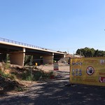


Welcome to the hiking route on B9 - B9! This super easy route covers a distance of 0.829 kilometers with no elevation gain, making it perfect for beginners or a relaxed nature stroll.
Starting at the parking area just 0.01 kilometers from the trailhead, you'll begin your journey through the picturesque surroundings. Along the way, you'll come across a convenient water source around 0.41 kilometers from the start, a great spot to refill your water bottle.
As you continue, you'll find an information point with wheelchair access located 0.08 kilometers from the start, providing interesting facts about the area. For those looking to take a break and enjoy the scenery, there are benches situated at the 0.25-kilometer mark, perfect for a peaceful rest stop.
This out-and-back route also offers additional parking options at the trailhead, allowing easy access to the start and end point of your hike.
Remember to bring plenty of water, wear comfortable shoes, and check the weather forecast before setting out on your adventure. Enjoy the leisurely pace and tranquil surroundings of the B9 - B9 hiking route!


