&fill=rgba(0,0,0,0))
Baslerstrasse


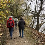
This hiking route takes you along Baslerstrasse, starting at a parking area near the trailhead. The trail is super easy, with a total distance of 1.099 kilometers and no elevation gain.
As you begin your hike, you'll pass by a bicycle parking area located 0.17 kilometers from the start. Further along the trail, at 0.24 kilometers in, you'll find a restaurant called Badi Beizli where you can stop for a meal or snack.
Around the halfway point, at 0.55 kilometers in, there is a water source for you to refill your bottles. As you continue on, make sure to check out the wayside cross located 0.39 kilometers from the start, and the information point at 0.27 kilometers in.
Towards the end of the hike, at 0.49 kilometers in, there is a bench where you can take a rest before turning back.
This out-and-back route is perfect for those looking for a leisurely stroll with amenities along the way. Remember to bring water, wear appropriate footwear, and check the weather forecast before heading out. Enjoy your hike along Baslerstrasse!


