Hiking : Büttelfels
Deutschland Rheinland-Pfalz Südwestpfalz Dahn
&fill=rgba(0,0,0,0))
Durée
Distance
Dénivelé

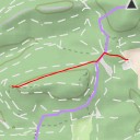
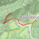
This hiking route will take you to the stunning Büttelfels area, known for its beautiful rock formations and picturesque surroundings in the Pfälzerwald region. The trail starts at the Sportpark P8 and winds its way through the Felsland Badeparadies area, offering ample parking options at P6, P4, and P5.
As you make your way along the trail, you'll come across the peaceful Büttelwoog water feature, providing a serene backdrop for your hike. Be sure to stop by the various viewpoints along the route, including the Büttelfels viewpoint which offers breathtaking panoramic views of the surroundings.
If you're in need of a rest, take a seat at one of the benches strategically placed along the trail or visit the biergarten at the Hotel Eyberg for a refreshing break. Don't forget to check out the information points along the way for interesting insights into the region's history and natural features.
The route is an out-and-back type, leading you to the Büttelfels destination and back to your starting point. With a total distance of approximately 1.088 kilometers and an elevation gain of 33 meters, this hike is of moderate difficulty. Be sure to bring plenty of water, wear sturdy hiking shoes, and check the weather forecast before embarking on this adventure. Enjoy the natural beauty and tranquility of Büttelfels on this scenic hike!