&fill=rgba(0,0,0,0))
Isarradweg
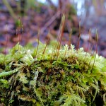


Welcome to the Isarradweg hiking route!
This picturesque route takes you through a beautiful area with easy terrain, making it perfect for hikers of all levels. The trail covers a distance of approximately 0.64 kilometers with no significant elevation gain, making it a super easy hike that can be enjoyed by everyone.
As you start your journey, you'll come across several points of interest along the way. You'll find benches scattered throughout the trail where you can take a break and enjoy the surroundings. Some benches are located right on the trail, providing a perfect resting spot for tired hikers.
Midway through the hike, you'll encounter the Hypoberg peak, offering stunning views of the surrounding landscape. This is a great spot to take in the scenery and snap some photos to remember your hike.
For those interested in learning more about the area, there are information points along the trail providing insights into the natural and cultural significance of the surroundings.
As you near the endpoint, you'll reach the Erholungsgebiet "Unterföhringer See," a recreational area where you can relax and unwind after your hike.
Don't forget to bring plenty of water, as the trail does not offer water stations along the way. Additionally, always check the weather forecast before setting out on your hike to ensure a safe and enjoyable experience.
Enjoy your hike along the Isarradweg and soak in the beauty of the surroundings!


