&fill=rgba(0,0,0,0))
TAC-Spitze
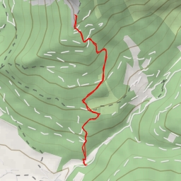
This hiking route will take you to the stunning TAC-Spitze, located in a beautiful area with breathtaking views. The total distance of the hike is 7.086 kilometers with an elevation gain of 728.0 meters, making it a difficult but rewarding trek.
Starting off, you will pass by the Polsterkar Höhle, a cave entrance located 2.02 kilometers from the start of the trail. As you continue on, you will come across the Leobner Hütte alpine hut at 1.97 kilometers from the starting point, providing a great spot to take a break and enjoy some refreshments.
Further along the trail, at 3.54 kilometers, you will reach the Hubert Wieser Klettersteig via ferrata, offering a thrilling climbing experience for those looking for an added challenge. Along the way, you will also encounter the TAC-Spitze peak at 3.54 kilometers, where you can bask in the panoramic views that the summit has to offer.
Hiking tips for this trail include bringing plenty of water, wearing sturdy hiking boots, and checking the weather forecast before embarking on your journey. It is recommended to start early to allow enough time to complete the hike and to bring along some snacks to keep your energy levels up.
Overall, this out-and-back hiking route to TAC-Spitze promises a challenging yet unforgettable experience for outdoor enthusiasts looking to immerse themselves in nature and conquer a majestic peak.